Ⅰ. Übersicht
Das LKST-X115 Low Altitude Surveillance Radar wird hauptsächlich für Überwachungsoperationen in geringer Höhe und am Boden eingesetzt. Unter Verwendung der digitalen Beamforming-Technologie zeichnet es sich durch eine geringe äquivalente omnidirektionale Strahlungsleistung bei gleichzeitig hohen Suchdatenraten aus. Das Radar verfügt über adaptive Störunterdrückung und Vorverfolgungssysteme für dichte Zielerkennung, wodurch extrem niedrige Fehlalarmraten erzielt werden. Es kann automatisch über 300 Zielgruppen verfolgen und deren Kurs ermitteln, wobei hochpräzise Positionsinformationen geliefert werden.
Ⅱ. Highlights
• Erfassung: ≥8 km (Quadrocopter) / ≥14 km (Person) / ≥15 km (Fahrzeug)
• 300 Spuren mit ≤5 m Reichweiten- & ≤0,4° Winkelgenauigkeit
• Extrem niedrige Fehlalarme bei starkem Clutter
• −3°–60° Elevation für komplexes Gelände
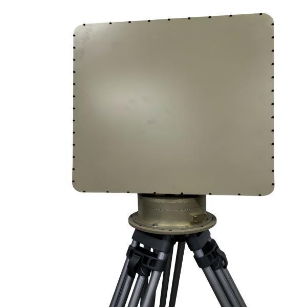
• ≤35 kg, ≤330 W für Fahrzeug- oder Rucksackeinsatz
Ⅲ. Spezifikationen
| Parametername |
Parameterwert |
| Betriebsfrequenz |
X-Band 9,8–10 GHz |
| Elevation-Abdeckung |
−3°–60° |
| Azimut-Abdeckung |
360° |
| Erfassungsreichweite |
Kleiner Quadrocopter (RCS 0,01 m²) ≥ 8 km
Kleines Starrflügel-UAV (RCS 0,1 m²) ≥ 12 km
Mittleres Starrflügel-UAV (RCS 1 m²) ≥ 15 km
Personal ≥ 14 km• Hubschrauber / Fahrzeug ≥ 15 km
|
| Maximale Erfassungshöhe |
≥ 2 000 m |
| Blindzone |
≤ 50 m |
| Reichw.-Genauigkeit |
≤ 5 m (RMS) |
| Winkelgenauigkeit |
Azimut ≤ 0,4° (RMS) / Elevation ≤ 0,4° (RMS) |
| Antennenrotationsgeschwindigkeit |
30 U/min (180°/s)
aufrüstbar auf 60 U/min (360°/s) |
| Gleichzeitige Spuren |
≥ 300 |
| Spurgeschwindigkeitsbereich |
1–150 m/s |
| Clutter-Unterdrückung |
Immun gegen gängigen Clutter |
| Betriebstemperatur |
−40 °C bis +55 °C |
| Luftfeuchtigkeit |
≤ 60 % |
| Schutzart |
IP65 (Haupteinheit IP67) |
| Gewicht |
≤ 35 kg |
| Leistungsaufnahme |
≤ 330 W |
| Array-Abmessungen |
540 × 675 × 85 mm |
| Auflösung |
4° (Azimut) / 7° (Elevation) |
| Sendeleistung |
≤ 30 W |
Ⅳ. Merkmale
1. DBF mit hoher Datenrate für schnelle Aktualisierung
2. Adaptive Clutter-Unterdrückung verwirft Regen-, Boden- & Seaclutter
3. Große Elevation für bergige und städtische Szenarien
4. Integrierte Aufnahme & Wiedergabe für Post-Missions-Analyse
V. Unternehmensstil

Ⅵ.Unternehmensveranstaltungen

 Ihre Nachricht muss zwischen 20 und 3.000 Zeichen enthalten!